Tehipite Valley
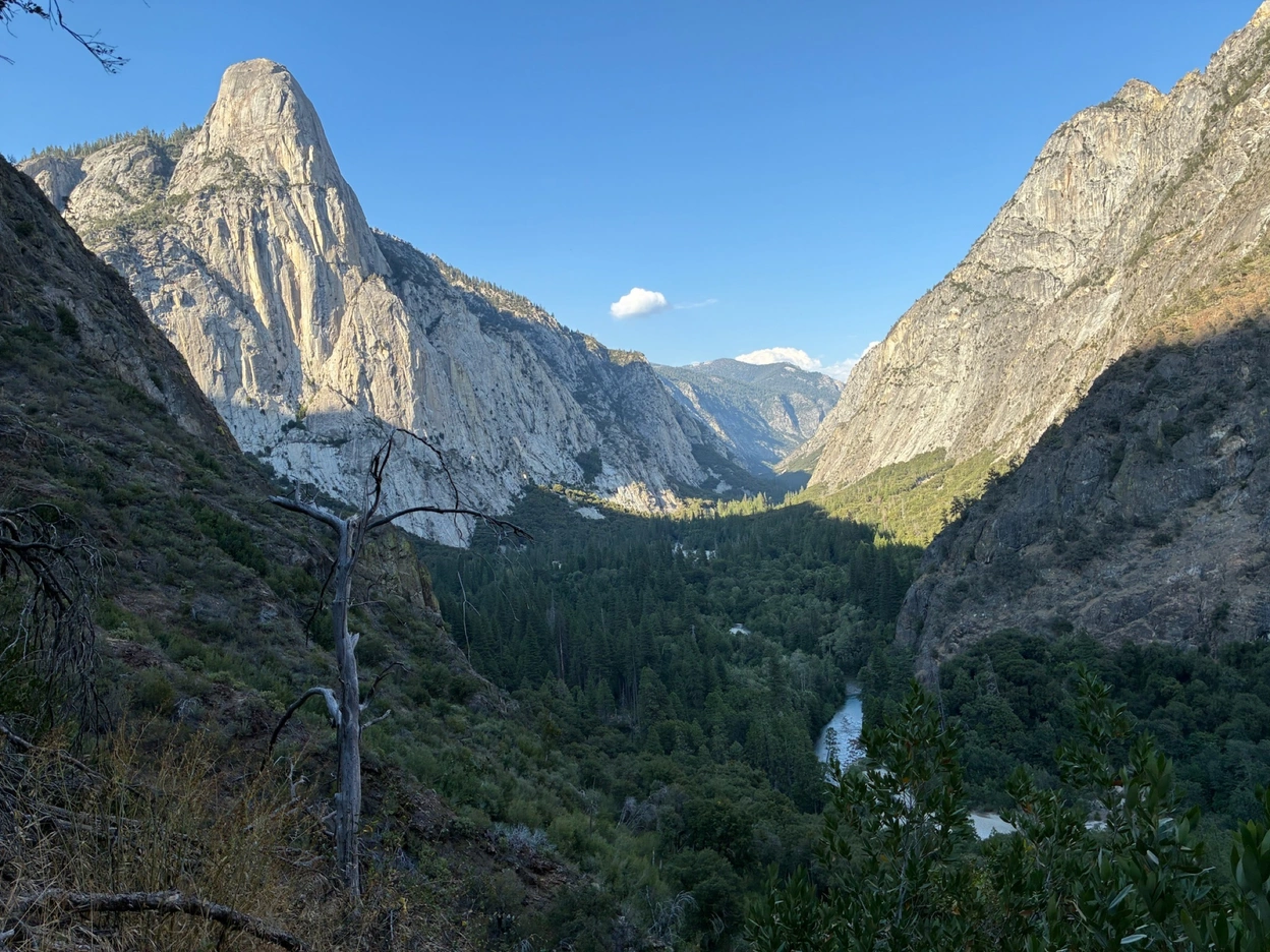
A couple years back, I came across a social media post detailing Tehipite Valley, a mystical remote valley in the Sierra Nevada. It was supposedly as grand and beautiful as Yosemite, but completely untouched and a massive undertaking to access. I must admit, I was influenced. By an influencer. The horror.
I did some research. The valley is very lightly documented on the internet. The hiking project trail page has only 3 reviews. There are only a handful of mentions on forums like Reddit and Sierra Topix.
The little information you can get from the trip reports makes it sound terrible. Bushwhacking and log hopping for 15 miles, unmaintained trails, blackberry bushes, rattlesnakes galore, unbearable heat, among other challenges.
Well, thankfully I have a friend crazy enough that all these descriptions make it even more appealing to him, and that is Max. After nagging me to plan this trip with him, we finally set a date, and began our trek out on Saturday, August 8th. We budgeted Saturday through Tuesday for the adventure.
Day 1
On Saturday, we set out at 5am, hoping to hit the trailhead early enough to get a good head start to the valley. While picking up permits at the ranger station, we were told that a wonderful ranger named "Tehipite Joe" had been maintaining the trails all summer, which gave us some optimism. To balance out that good news, the area was in the midst of a heat wave and it was already in the 90s by 10am when we stopped for lunch.
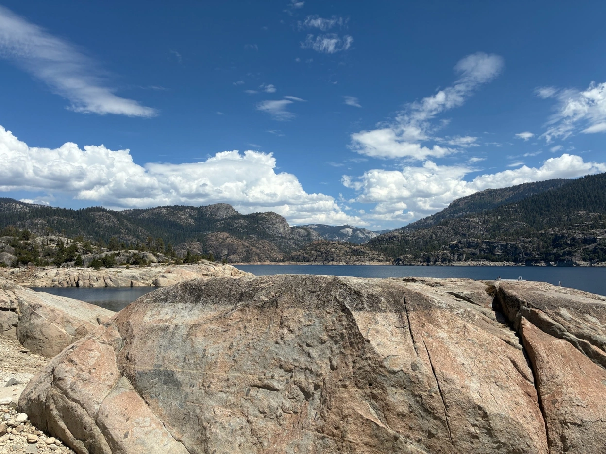
We made it to the trailhead by noon, crossing the spectacular Wishon Reservoir on the way. I did not know this place existed, and would love to come back.
We began our hike. The first 7 miles or so of the trail were in excellent condition. However, without any time to acclimate to the altitude, Max and I were fairly tired from around 2000 feet of elevation gain or so. We took a much-needed snack break, and I even managed to catch and release my first fish, a colorful brook trout!
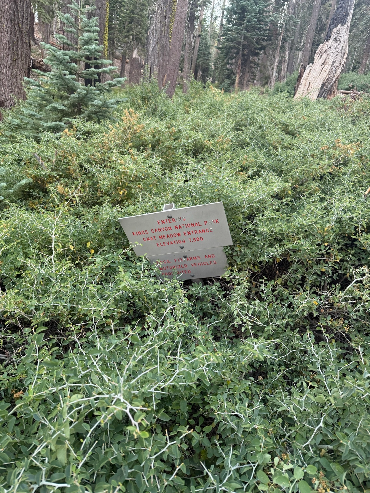
Soon after this, we crossed the boundary into Kings Canyon National Park, and the trail quality quickly deteriorated. From this point forward, we were entirely dependent on GPS maps to find the trail. Every few minutes, we had to hop logs or push through sections of whitethorn bushes. With heavy packs on, this added a significant amount of fatigue.
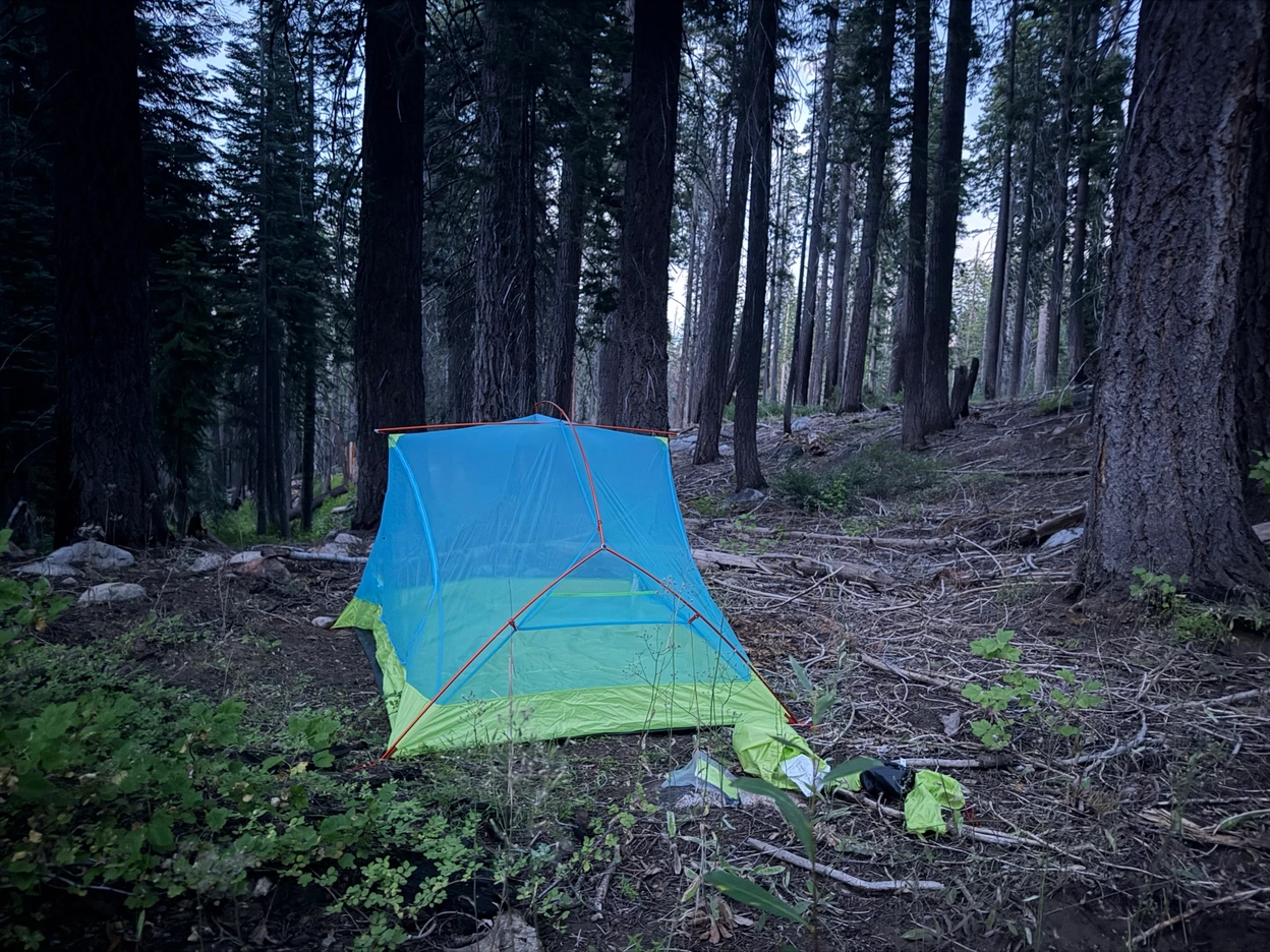
Finally, after about 11.5 miles, the sun had set, so we decided to set up camp at a reasonably flat area and call it a night. It wasn't the most pleasant campsite—we needed to clear sticks and rocks, and there were some burnt trees not too far from the tent, but it was the best we could do with our situation.
Day 2
We set out for the valley around 8am, only around 6 miles to go before the valley. The first two miles wouldn't have been too strenuous, but finding the trail proved challenging, and the whitethorn bushes and thick forests of young pine saplings were physically challenging to push through. In addition, the many burnt trees we needed to hop seemed to be getting bigger and bigger, as we trekked through a forest of giants.
Finally, we reached the rim at around 10am. Max and I had made a little bet on when we would arrive at the valley floor, with the line set at noon. I guessed after, Max guessed before.
I won the bet. The final 2 miles to the valley were mentally and physically exhausting. It was around 3000 feet of elevation loss in the 2 miles, and the trail was the perfect combination of overgrown and sketchy. It was as if I took the steepest section of the steepest hike I have ever done, and then extended it to 2 miles long. I fell on my butt 3 times, but thankfully no injuries. At least the views were good the whole time.
By the time we had reached the bottom, we were spent. We headed straight to the river for a swimming break, as it had easily reached 100 degrees and we were both dirty and likely poison oaked. And wow, did our moods change quickly. We swam under the imposing figure of the great Tehipite Dome, ate our lunch spamwiches, rinsed off, and finally made our way to the center of the valley, where we would pitch our tent for the night. Just one section of trudging through blackberry bushes to put a cherry on top of the whole adventure.
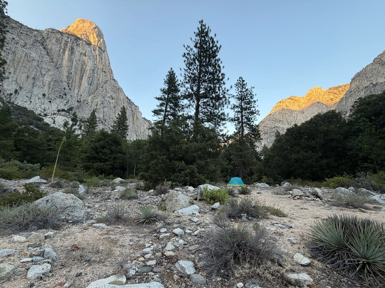
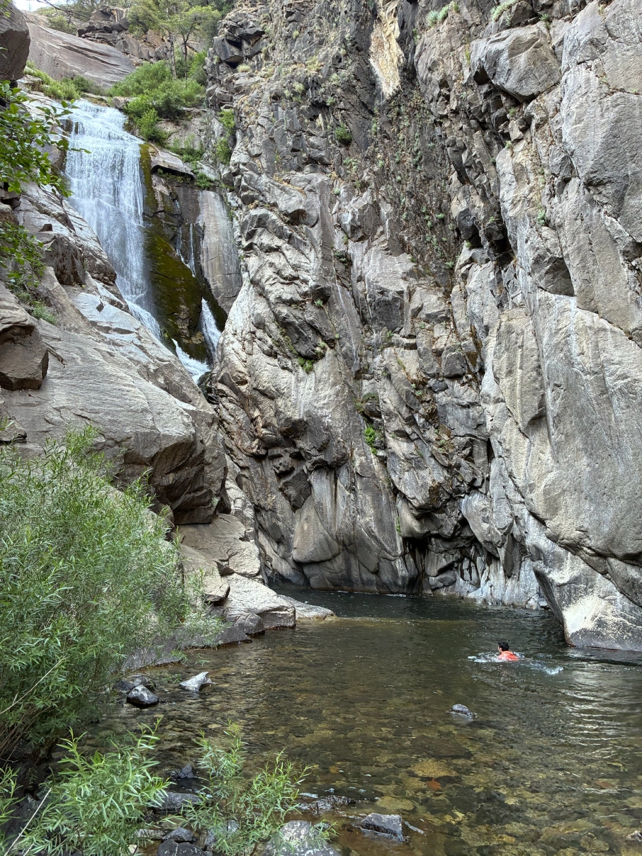
Once we established our home base, we spent the rest of the day fishing, lounging and exploring, including seeing the nearby Silver Spray Falls, a spectacular waterfall that exceeded both our expectations!
We capped off the excellent day by watching the peak of the Perseids meteor shower.
Day 3
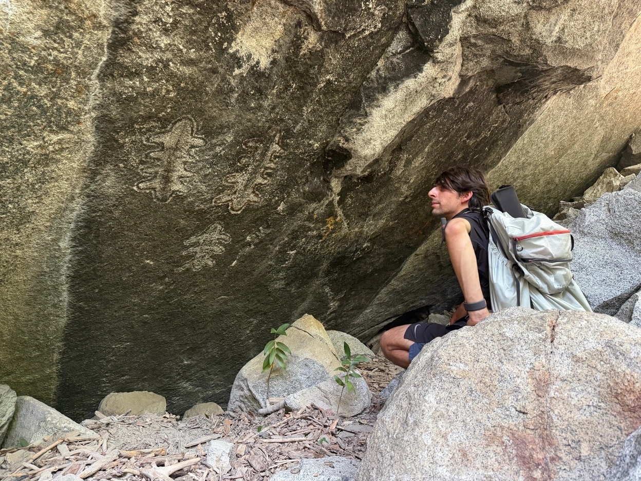
We spent the morning exploring the valley. First stop was painted rock, the petroglyphs on a large boulder near the Kings River. I was amazed by the setting; it was located in a large rock field that formed talus caves and fun terrain to hop and climb over, and the particular rock with the painting was perfectly situated to provide shelter from wind and rain. This is probably why the painting is still in such good condition, and why it was made there in the first place! It was a special experience to see this up close.
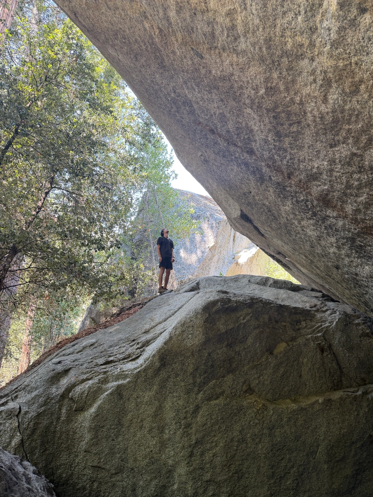
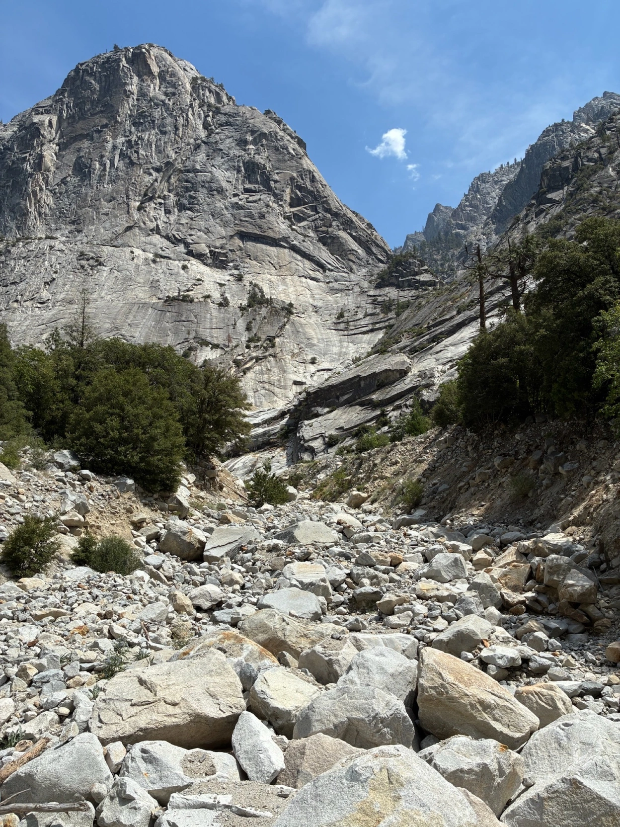
Our next stop was Crystal Creek, one of the rivers that forms the "Gorge of despair", the rock formation across Tehipite Dome filled with dramatic spires and featured faces. To get here required bushwhacking through the valley of the trail, which proved surprisingly difficult, but it also made us appreciate the everchanging landscape of the valley. While some areas were easily navigable evergreen forests, we often found ourselves in thick and overgrown oak forests, crumbly gravel hills, creeks with rocks to hop, and large boulder fields that required climbing or careful descent. It was a short but varied journey that made me appreciate all the work it takes to clear our roads and paths in lush environments like this.
Eventually we found a wide section of the great Kings River that was crossable, took off our shoes, and climbed a bit up into Crystal Creek to admire the view. It was absolutely worth it.
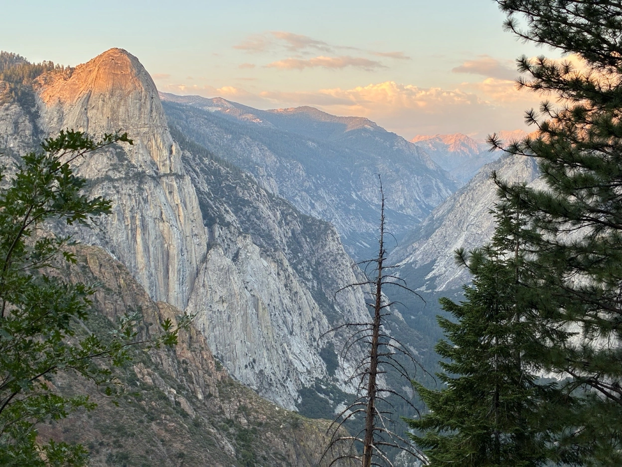
We headed back to camp, where we made an early dinner, and started the ascent out of the valley during golden hour. As we ascended, we watched Tehipite Dome slowly acquire a classic Sierra Nevada orange sunset tint and then fade into night. While the climb was a physical battle, the view at times was so breathtaking that I shed a few tears.
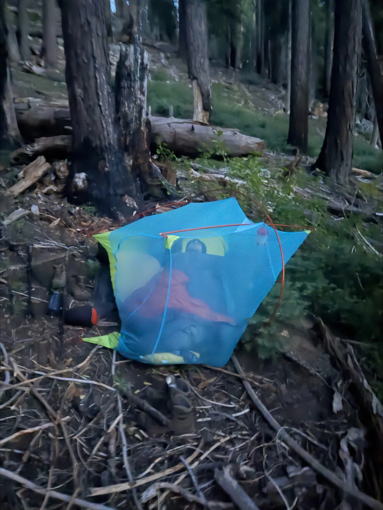
Our final campsite was terrible. We hiked until we reached the first water source, which happened to be on a hillside with absolutely no flat ground. Our best camping spot we could find, besides the trail itself, was at a steep angle, and I found myself counting down the time until sunrise. I took a pretty hilarious photo of Max in the tent, which had slid down the hill 5 feet, half in a tree.
Day 4
We cruised through the final 12 miles of the hike, and made it to the car by early afternoon. By that point, we had been through much worse, so the 2000+ feet of elevation gain on well maintained trails felt like a breeze.
Recap
Tehipite was a blast. There is something so cool about having a valley with a similar grandeur to Yosemite or Kings Canyon all to yourself. If there was a road going here, it could absolutely be an internationally recognized tourist attraction. It made me appreciate nature in its actual natural form, which is not necessarily accommodating to humans for exploring it. The trip also made me appreciate the work that government agencies, trail crews, and volunteers put into maintaining trails and infrastructure that I sometimes take for granted and think of as "untouched" wilderness, when really it is modified for our own leisure.
I will probably wait at least a few years before I attempt Tehipite again, and I would only recommend it to experienced hikers who can withstand some discomfort and extreme physical effort.
Random Notes
-
Max managed to not only spill his leaky bug spray all over his backpack, permeating into every single one of his items, and resulting in a comically toxic mouthful of trail mix, but also brought the world's meltiest deodorant, which imbued a lovely "Degree shower clean" scent over our entire food supply for the rest of the trip.
-
We heard a terrifying crash and boom of a tree falling in the forest on our final evening. We may have been the only ones to hear it, and it indeed made a sound.
-
I got a grand total of 80 mosquito bites on my body, and I'm pretty sure 90% of them were on the ascent out of the valley. I didn't expect mosquitoes to be so bad in mid-August in such a hot environment, but I was proven wrong.
-
To anyone who is considering going to Tehipite, my number one piece of advice is to download the map of the trail; it proved extremely accurate, and it was so easy to lose the trail without GPS and the offline map.